


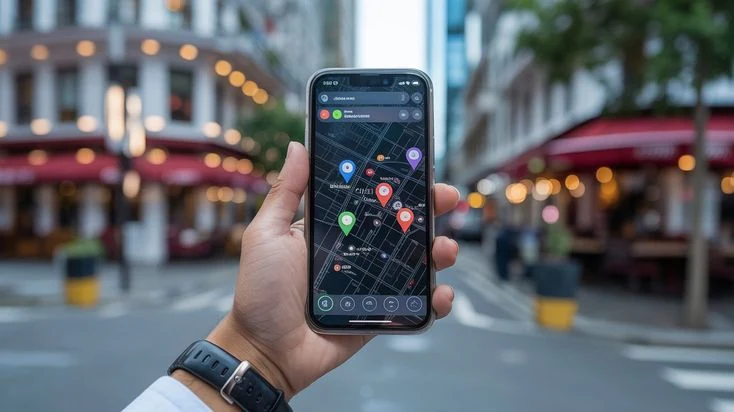

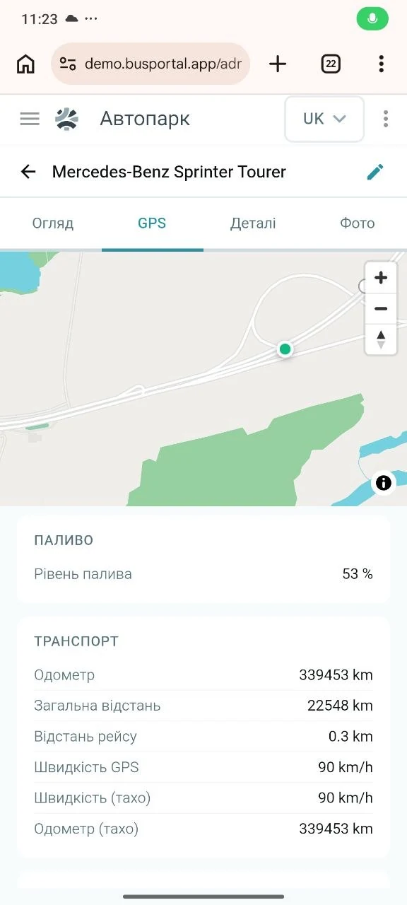
If the model and firmware of the GPS tracker support a second server, the BUSPORTAL address is simply added to its settings. The same stream of coordinates then reaches both the system you already use and BUSPORTAL. The platform identifies the right bus by the unique device number — the IMEI.

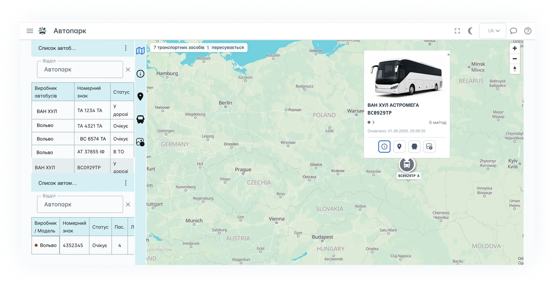
Real-time GPS tracking for buses
The dispatcher sees where every bus is, whether it is keeping to the schedule and which stops it has already passed. The passenger can open the live map of the trip straight from their e-ticket — no separate app needed.
BUSPORTAL receives coordinates from the GPS trackers fitted in your buses or from the driver's smartphone and shows the whole fleet on one map.
Try Live Pilot for free
- Every bus on one map
- Automatic delay detection
- Movement history for every trip
- A live bus map for the passenger
GPS TRACKING
What GPS tracking for buses means in BUSPORTAL
GPS tracking for buses means following the fleet by its real-time coordinates. In BUSPORTAL the position of a bus is tied not only to the vehicle, but also to a specific trip, route and schedule.
So the dispatcher does not just see a dot on a map. They know which trip the bus is running, whether it is late, which stop it has passed and when to expect it further along the route.
TRACKER
A tracker in the bus or the driver's smartphone
Tracking can run on the equipment you already have or on the driver app. Both sources of coordinates appear on the same BUSPORTAL map.
Before the launch, the BUSPORTAL team checks the equipment already installed in your buses. If the system supports the way it transmits data, there is no need to replace the trackers.
For VD-EXPRESS, for example, Teltonika equipment is used. Whether devices from other manufacturers can be connected is decided after checking the model and its data transmission method.
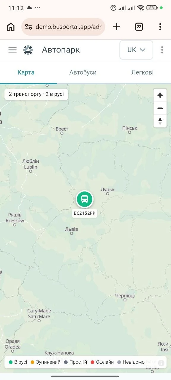
The driver's smartphone instead of a dedicated device
If a bus has no GPS tracker, or the tracker is temporarily out of order, the coordinates can be sent by the Android driver app. This makes it possible to start tracking without buying equipment for every bus.
While the bus is moving, the app is careful with the phone's battery, and near the stops it refreshes the coordinates more often to record the arrival more precisely.
NO DATA IS LOST
No data is lost when there is no mobile signal
If the internet drops out on the route, the driver's smartphone stores the coordinates for a while. Once the connection is back they are sent to BUSPORTAL automatically, so the movement history does not break on sections without coverage.
To get started with BUSPORTAL you do not have to give up the GPS service you already use straight away. The systems can run in parallel, and you can start with just a few buses.
ONE TRACKER — TWO SYSTEMS
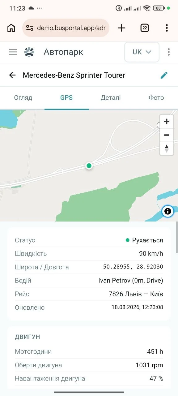
One tracker can send data to two systems
If a second server is not supported
When the tracker model cannot send data to two systems at once, the driver app can serve as the backup source of coordinates. Your GPS service keeps receiving data from the installed equipment, while BUSPORTAL gets it from the driver's smartphone.
BUSPORTAL does not have to replace your GPS service
Your existing system can go on answering the question “where is the vehicle and what is happening with the fuel”. BUSPORTAL adds a second layer: which trip the bus is running, whether it is keeping to the schedule, which stops it has passed and what the passenger sees on the live map.
You can start with part of the fleet
Connect a few buses and see how it works on real trips. At the start there is no need to decide whether to replace the system you already use, or to pay for two services for the whole fleet.
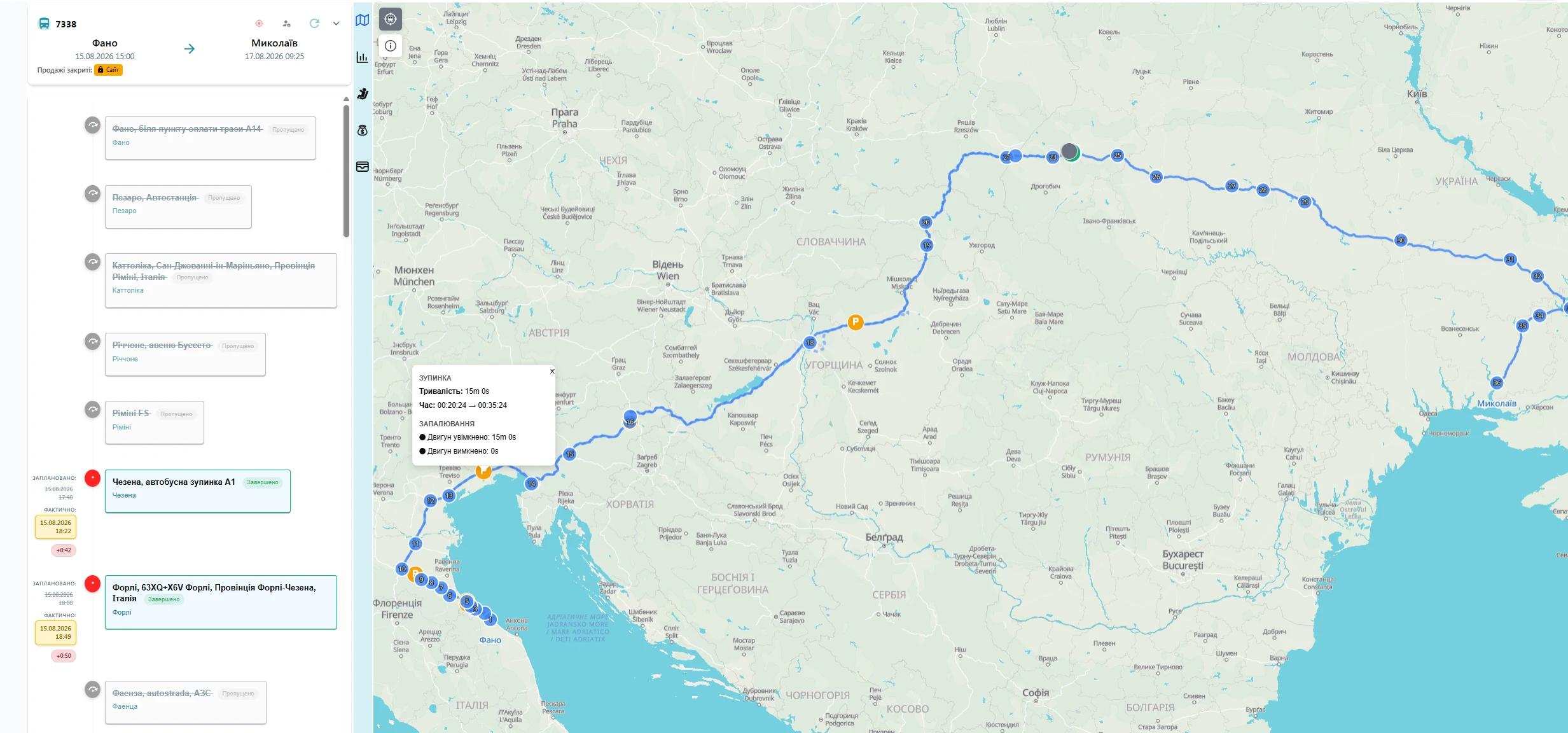
The whole fleet on one map
The dispatcher opens BUSPORTAL and sees the current state of the trips without switching between different programs
Position and direction of travel
The map shows where the bus is, how fast it is going and in which direction. For every bus you also see the trip it is currently running.
The path travelled
The system draws the actual path of the bus over the planned route. The dispatcher can look at the movement right now or at the history of a finished trip.
History helps recover a missed record
When a single coordinate does not come through because of a weak signal, the system checks the stored movement history and can find the actual moment of arrival later.
The dispatcher sees missed stops
If the bus has passed the next stop while no arrival was recorded at the previous one, BUSPORTAL marks that stop as missed. This lets you spot the problem before a passenger calls.
The dispatcher can correct the data
Automatic recording does not take control away from your staff. The dispatcher can confirm an arrival or a departure, or correct a wrong mark.
Delays are visible without manual maths
BUSPORTAL compares the planned and the actual times at the stops. Deviations are highlighted in colour, so a problem trip stands out immediately.
For the stops ahead the system shows the estimated arrival time, taking the current deviation from the schedule into account.
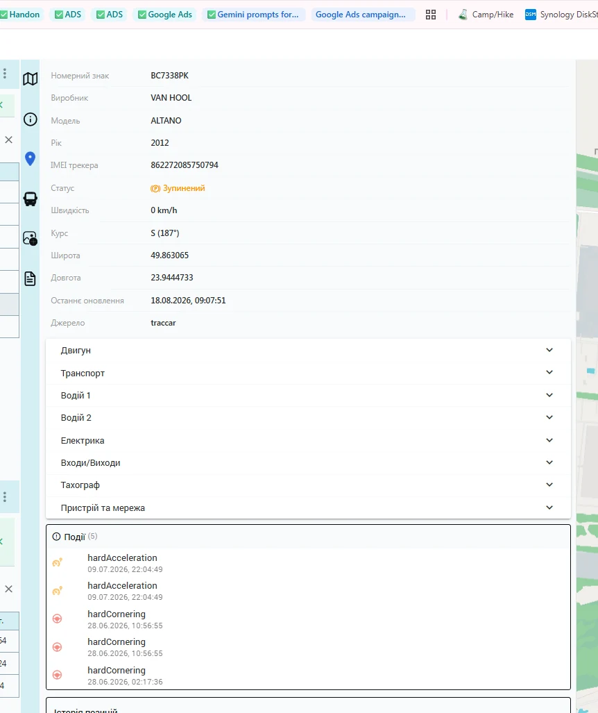

Events and violations during the trip
Instead of a long list of coordinates, the dispatcher gets a readable history of events:
- the start and the end of the trip
- arrival at, departure from or a missed stop
- exceeding the set speed
- deviation from the route
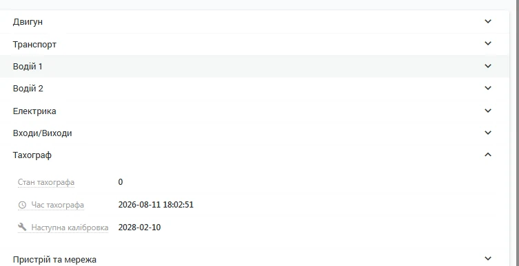
If the installed GPS tracker sends additional data, BUSPORTAL can also show harsh acceleration or braking, dangerous cornering, an impact, towing, signal loss and other events.
Which events are available depends on the tracker model and the sensors connected to it. The owner can therefore review driving style and disputed situations on the basis of recorded data, not just verbal explanations.
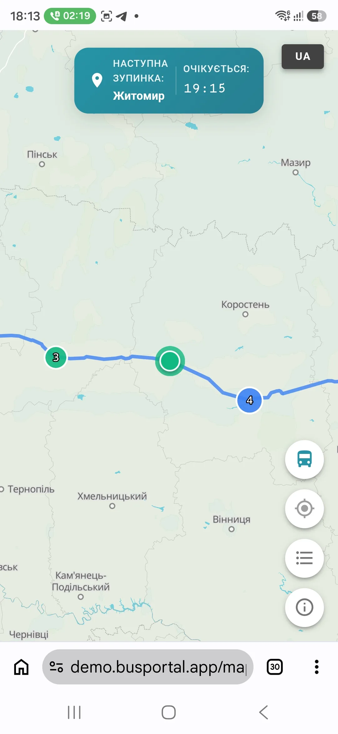
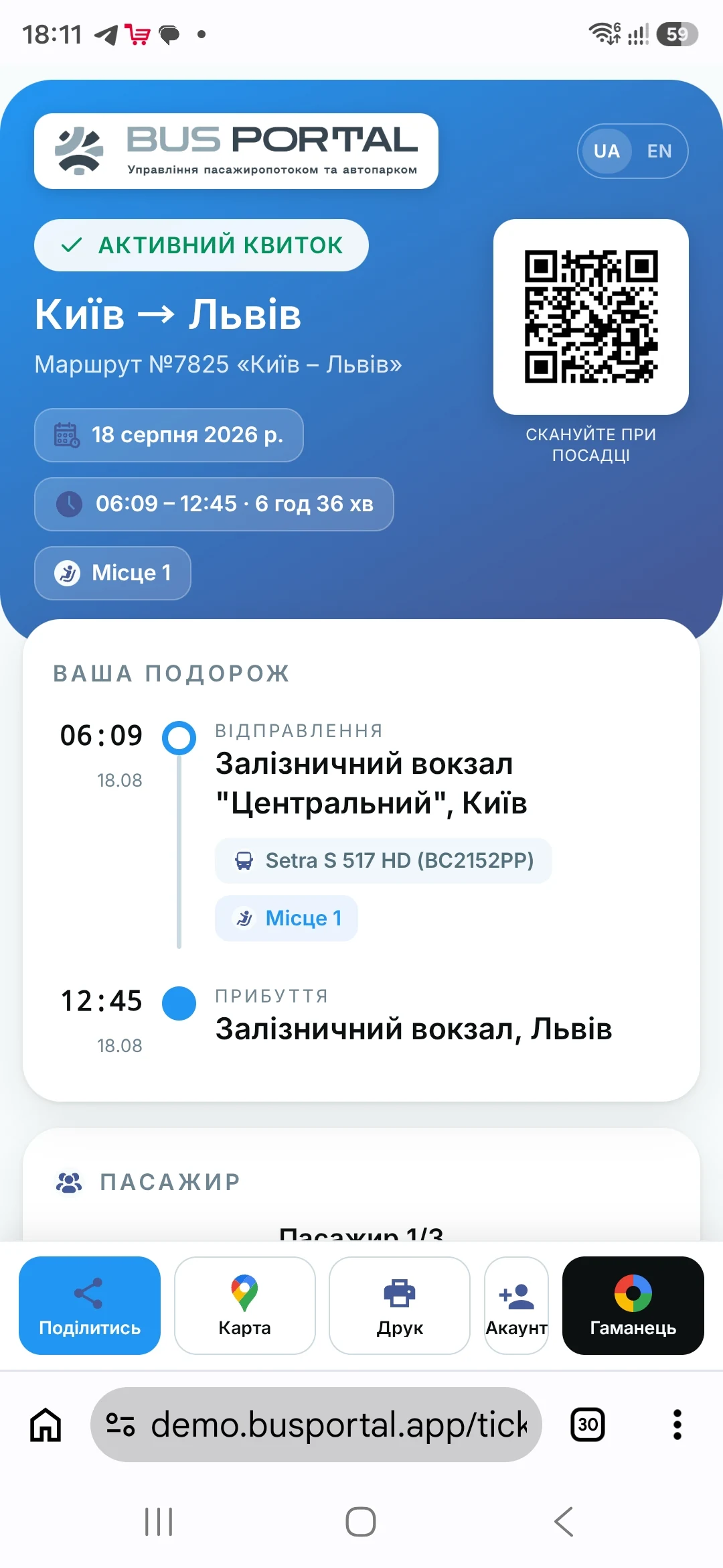
the bus inside the ticket
The passenger sees the bus from their own ticket
The passenger's e-ticket contains a link to the live map of the trip. The page opens in the phone's normal browser — there is no separate app to install.
On the map the passenger sees:
- the current position of the bus
- the route and the stops of the trip
- the next stop
- the estimated arrival time
- information about the bus and the carrier's contacts
- their own position relative to the pick-up point
The passenger only sees the information they need for their own trip. The dispatcher's internal data and details of other passengers are not shown.
If another bus is assigned to the trip, the map switches to the new vehicle. Once the trip is over, the live position is no longer transmitted.
For the carrier this means fewer calls asking “where is the bus?” and “will I make it to the pick-up point?”. The passenger gets the answer themselves before the bus even arrives.
comparison
How BUSPORTAL differs from a standalone GPS service
An ordinary GPS service shows vehicles on a map. BUSPORTAL combines the coordinates with the trip, the schedule, the stops, the driver and the passenger service.
| A standalone GPS service | GPS tracking in BUSPORTAL |
|---|---|
| Shows a dot on the map | Shows the bus in the context of a specific trip |
| The dispatcher works out the delays themselves | The deviation from the schedule is calculated stop by stop |
| Stops passed are often marked by hand | Arrivals and missed stops are detected automatically |
| The passenger cannot see the internal map | The passenger gets a separate live map from their ticket |
| Yet another program for the dispatcher | Trips, tickets, drivers and GPS all work in one account |
history
Movement history and reviewing disputed situations
Once a trip is over, the path travelled, the events and the actual times at the stops are stored. GPS position history is available for 90 days. If a hardware tracker sends data on mileage, fuel and other readings, they are stored along with the coordinates.
The owner or the dispatcher can check:
- when the bus actually started and finished the trip
- on which section the delay appeared
- whether the delay repeats in the same place
- where the bus was at the moment of a complaint or an incident
- the actual path and mileage recorded
Instead of reconstructing events from what the driver and the passenger say, the responsible member of staff opens the trip history and sees the recorded movement on the map.
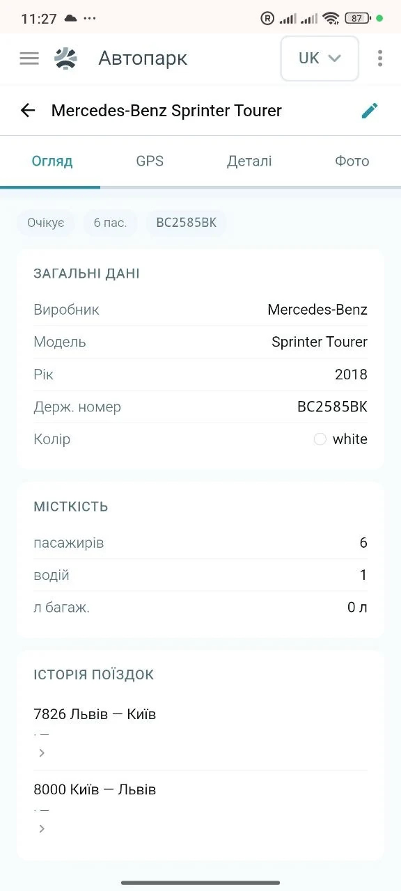
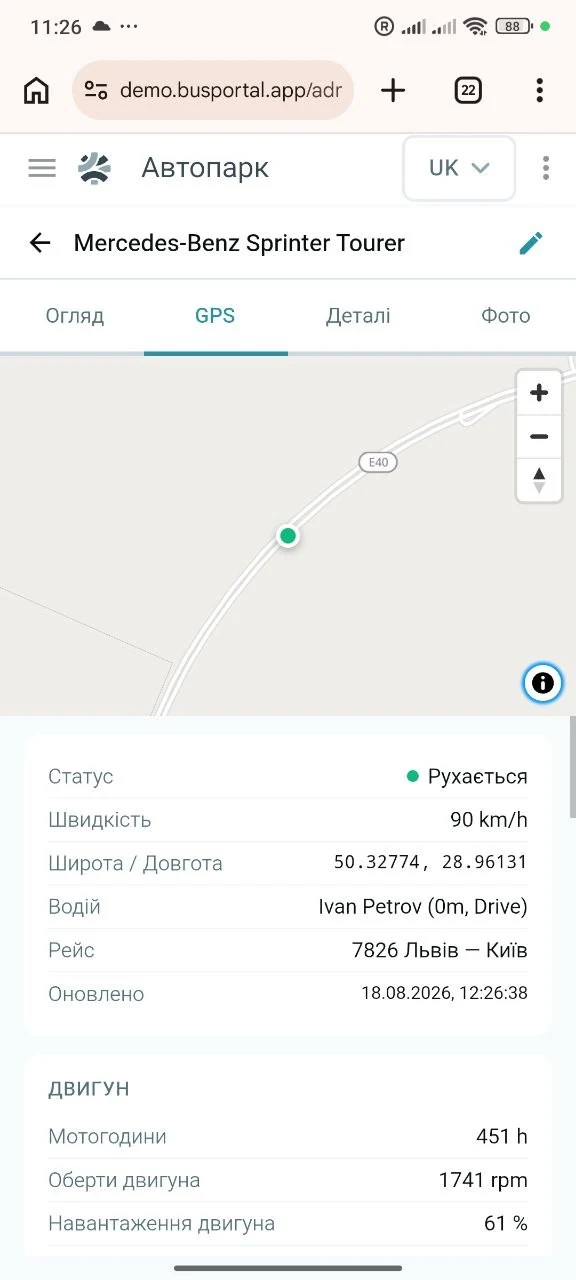
getting started
How to set up GPS tracking for buses
- 1. We check the equipment you haveWe find out which trackers are installed in your buses and whether they can be connected.
- 2. We connect the sources of coordinatesWe use the existing trackers, the driver app, or both.
- 3. We check the routes and stopsTo monitor the schedule, the system needs to know the route, the order of the stops and where they are.
- 4. We watch the first trip togetherWe check the map, the stops passed, the delays and the events.
- 5. We open the map to passengersA link to the live trip map appears in the e-ticket.
GPS tracking works inside BUSPORTAL, so there is nothing to connect separately to your trips, tickets and dispatcher's work.
WHAT YOU GET
What the fleet owner gets
- control over the whole fleet on one map
- automatic detection of delays and missed stops
- fewer calls between drivers, dispatchers and passengers
- movement history for reviewing complaints and incidents
- the option to use existing trackers or the drivers' smartphones
- a live trip map as an extra service for passengers
VD-EXPRESS implementation example
At VD-EXPRESS the bus coordinates come from Teltonika equipment and are used together with BUSPORTAL trips and schedules. The carrier sees the vehicles moving, and the passenger can open the map of their own trip.
The VD-EXPRESS route data has also been prepared for Google Maps and open transit sources. That is a separate BUSPORTAL capability: GPS answers the question “where is the bus right now”, while the schedule data helps the passenger find the route in the first place.
Read the VD-EXPRESS case study

FAQ
Can we connect GPS trackers that are already installed in the buses?
Yes. Before the launch the BUSPORTAL team checks the equipment already installed in your buses: if the system supports the way it transmits data, there is no need to replace the trackers.
Do we have to give up the GPS system we already use?
No. If the model and firmware of the tracker support a second server, the same device can send coordinates to your GPS system and to BUSPORTAL at the same time. If that is not possible, the driver app can be used for BUSPORTAL. You can start with a few buses and decide how to handle the whole fleet once you have seen it working.
What if a bus has no GPS tracker?
The coordinates can be sent by the Android driver app — this makes it possible to start tracking without buying equipment for every bus.
How often is the bus position updated?
The driver app changes how often it sends coordinates: while the bus is moving it is careful with the phone's battery, and near the stops it refreshes the coordinates more often to record the arrival more precisely.
What happens if the mobile internet drops out on the road?
The driver's smartphone stores the coordinates for a while and, once the connection is back, sends them to BUSPORTAL automatically — the movement history does not break on sections without coverage.
Does the passenger have to install an app?
No. The link to the live trip map is in the e-ticket, and the page opens in the phone's normal browser.
Can the passenger see internal information or other people's data?
No. The passenger only sees the information they need for their own trip; the dispatcher's internal data and details of other passengers are not shown.
How does the system detect arrival at a stop?
Arrivals and missed stops are detected automatically from the coordinates. If a single coordinate does not come through because of a weak signal, the system checks the stored movement history and can find the actual moment of arrival later, and the dispatcher can confirm or correct the mark by hand.
Does the system show speeding and harsh manoeuvres?
The map shows the speed and the direction of travel of every bus. If a hardware tracker sends data on mileage, fuel and other readings, they are stored along with the coordinates.
How much does GPS tracking cost?
GPS tracking works inside BUSPORTAL and is part of the platform subscription — there is nothing to buy separately. The price of the subscription depends on the plan you choose.
How long does it take to get started?
The launch takes five steps: checking the equipment you have, connecting the sources of coordinates, checking the routes and stops, watching the first trip together and opening the map to passengers.
Can we try the system before committing?
Yes. Connect a few buses and see how it works on real trips — at the start there is no need to decide whether to replace the system you already use.
We will show GPS tracking on your own route
In a 30-minute demo you will see the fleet map, the trip history, the deviations from the schedule and the page the passenger opens from their e-ticket.
Try Live Pilot for free